Saturday, October 22, 2011

Favorite Anchorages - Cullen Harbor, Queen Charlotte Strait

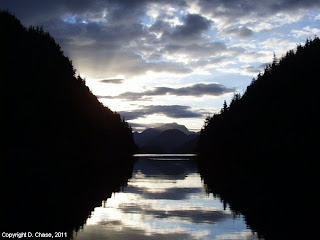
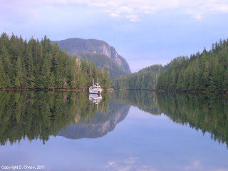
It's rainy, windy, fall mornings like this that have me dreaming of summer cruising both past and future.  As I sip my morning coffee I can imagine myself sitting in the MV Independence at some remote anchorage and watching the rain come down.  The image that many times comes to my mind is the anchorage at Cullen Harbor just at the entrance to Fife Sound at the far northeastern corner of Queen Charlotte Strait.  For all the anchorages between Puget Sound to Alaska this has got to be one of, if not my most favorite anchorage.  Oh so many memories of fishing nearby, playing in the tidal rapids in Booker Passage, exploring the many islands and bays, scuba diving, seeing wildlife - dolphins, whales, seal lions and bears, and meeting friends here.  How many times we said, "Let's just stay another day here."

Click on above to enlarge
Cullen Harbor is a great all weather anchorage.  Depths average around the harbor at 30'.  The bottom holding is good with a hard but pliable clay bottom with kelp that will really allow the flukes of your anchor to dig in.  I've never dragged anchor here.  The harbor has room for about 20 or more boats but I've never seen that many here.  It's especially well protected from any stormy SE winds.  We've hunkered down several times here to escape some pretty nasty blows.  If you want privacy there's a few little nooks you can anchor in.  If you really want privacy or protection you can anchor in nearby Booker Lagoon too.  No wind or swell will enter the lagoon.  And, not too many folks are willing to navigate Booker Passage to get into Booker Lagoon.  Traveling Booker Passage is easy during slack tide and you don't have to worry about any shoal water.  I've scuba dove the entire cut and the shallowest it gets is 40'.  There's four good anchoring areas within the lagoon, the prettiest being the far western bay.

inukshuk
Booker Lagoon offers great gunkholing for those days when the weather "outside" in Queen Charlotte Strait is nasty.  The lagoon gets filled with moon jellys during the summer.  We fully explored the many islands in and around the lagoon erecting inukshuks on them and searching for trinkets and treasures.  Some of the islands made for a great picnic spot or sunny spot to read a book.  We've done crabbing and shrimping in the lagoon too.  For many summers a pair of white-sided dolphins lived in the lagoon entertaining any visiting boater with jumps and tail dances.  We even snorkeled with the dolphins and that was an adventure that will live forever in our minds.  The dolphins would come at you out of nowhere and quickly turn just inches from you.  They would jump over you.  And sometimes would stop and hover close to your mask to get a good look at you.  It was fantastic.

Snorkeling in Booker Passage
If you're a scuba diver or a snorkeler, diving Cullen Harbor and Booker Passage is world class.  There's plenty of exotic underwater wildlife and things to see... Puget Sound King Crab, octopus, rock fish, basket stars, anemones, tube worms, kelp forests, and so much more.  Diving here is not to be forgotten, as it is one of the best dive sites on the west coast.  Many times you will see dive charters from nearby Port McNeill diving Booker Passage during slack tide. (Contact Sun Fun Divers in Port McNeill to book a charter)  When boating make sure to give them wide passage.

There's plenty of good fishing opportunities just outside of Cullen Harbor in Fife Sound.  Note that all of Cullen Harbor, Booker Lagoon, and the islands around Booker Passage are all protected as a Rockfish Conservation Area.  However the steep north and south shores along Fife Sound offer good fishing for ling cod and salmon.  Try trolling the tide rips that form at the entrance to Fife Sound and chances are you'll get coho or pink salmon when in season.  Early mornings trolling very slowly along the rocky steep  walls might even get you a nice sized Chinook salmon.  We've even caught halibut just outside of Cullen Harbor.  Large balls of herring or eulachon or pilchards will enter Cullen Harbor too.  Fish around these and you might get lucky with a big fish - we have.  If you want shrimp and prawns you'll need to travel farther down Fife Sound as the currents just outside of Cullen Harbor are too strong for good shrimping.  Although there's a few shrimp in Booker Lagoon.

Steller's sea lions just off of Screen Island in Fife Sound
For wildlife, many times you can find humpback whales just outside of Cullen Harbor.  Blackfish (small pilot whales) will enter Cullen Harbor to feed.  Just south of Cullen Harbor, across Fife Sound you will see a large rocky island (Screen Is.) that is popular with very large Steller's sea lions.  You can hear them barking and growling on quiet mornings while anchored in Cullen Harbor.  If you motor or kayak by this island you will see them swimming about, or sitting on the rock, or if lucky jumping off the rock and into the water.  The bulls weigh as much as 1,000 pounds and they'll make a huge splash when jumping in.  You can see killer whales in the area too.  One year, late in the season, we were entertained with hundreds of white-sided dolphins.  They were jumping, tail dancing, and splashing about just off of Eden Island.  It was quite the spectacle.  Of course you can always get a chance to see black bears.  If you are lucky you'll see them swimming from island to island looking for food.

Boys going exploring in Cullen Harbor
Finally one of the best features for my adventurous boys were to play in the tidal rapids in Booker Passage.  During large flood spring tides the current will create a large overfall and standing wave of about four feet and a subsequent whirlpool of about 10-15' in diameter.  If you have a dinghy with an 8 HP motor or larger you can safely navigate these tidal rapids.  I wouldn't try the rapids in the MV Independence though.  One year we had all of us in our dinghy and we couldn't make it out through the tidal rapids - the current was just too strong and it was not safe with the waves.  So we retreated to a small rocky island, had a snack, went beach combing, and waited three hours when the current was much less and then we easily made it back to the MV Independence anchored in Cullen Harbor.  But oh how the boys loved the adventure and the thrill, and it made for many long discussions of "how we were stranded and may never make it back."

If you need provisions Echo Bay is an easy 13 nautical miles away.  Port McNeill is about 25 nautical miles away.  You can use Cullen Harbor as a base to explore the many islands and bays around Eden, Mars, and Bonwick Islands just to the south of Cullen Harbor.

For me, Cullen Harbor and Booker Lagoon are small pieces of heaven on earth.  So many wonderful memories occurred in these places.  I think I'll take another sip of coffee, close my eyes, and enjoy the memories a little bit more.  Did I say it's raining, windy, and gray outside?

Want to read more about shrimping or crabbing or fishing?  Or cruising to the Broughtons?  Try visiting these previous blog posts:

Saturday, October 15, 2011

Summer Trip Planning - Going Beyond Cape Caution

I know it's fall and the summer cruising season is just over, but this is the time I start planning for next summer's cruising adventures.  There's a whole new experience of wilderness cruising called the "BC Central Coast."  This area stretches from Queen Charlotte Strait in the south to approximately Klemtu in the north.  It is an area that will provide cruising adventures for a lifetime.  There are several spectacular cruising areas within the Central Coast such as Rivers Inlet, Hakai Pass, Ocean Falls, Fjordland and more.  However to get to these dream cruising places you've got to cross Queen Charlotte Sound and go beyond Cape Caution.  This can be a significant cruising challenge for any boater - experienced or not.  You will have to deal with open ocean waves and swell, strong currents, and shoal areas.  Several times I have made this trip without any problem, but a few times the crew was seasick and about ready to mutiny.

Click on chart for larger image
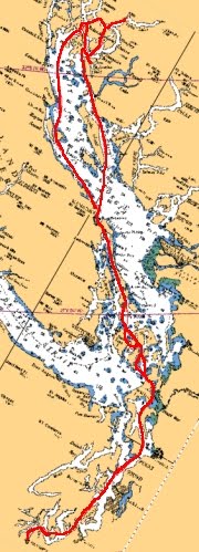
There are two major routes to go beyond Cape Caution, one is to take the more direct route from Port Hardy, and the other is to follow the lee shore and go along the mainland coast.  The route from Port Hardy is shorter, more direct, and has less challenges of current and shoal areas, but is also more open to weather and provides few opportunities for shelter.  Once you leave the Goletas Channel area you are committed to go all the way.   I have done this and have spent several hours in very uncomfortable beam seas as the waves and swell came from the west and I'm traveling north.  I often jokingly say, "The only thing stopping the waves and swell here is Japan." Currently the crew does not like this route at all and will immediately object if I suggest it.  The other route by going along the mainland shore offers you more opportunities for shelter and less beam seas, but you have to deal with currents and shoals.  This is the preferred route that we normally take when going beyond Cape Caution.

Click on above chart for larger image
The planning for the mainland route crossing starts at Blunden Harbor which is a great all weather anchorage with excellent holding.  We've waited out several blows in this harbor.  There's plenty of exploring to do and there's good crabbing too.  To start planning for this crossing, listen to the weather forecast for the Central Coast from MacInnes Island to Pine Island.  You'll want to listen to lightstation weather reports at Pine Island and Egg Island along with the continuous reports from Herbert Island and West Sea Otter.  The lightstation reports and the weather buoy at West Sea Otter will give you an idea of the sea conditions of wave height and swell.  My suggestion is if the wind is anything greater than 15 knots and seas of three foot moderate or more, you're in for a rough and uncomfortable ride.  You will also want to consult the tide and current tables for Nakwakto Rapids.  Do not travel the "mainland route" during any kind of large ebb with winds over 15 knots.  If you do you will experience rough and steep seas particularly by the Jennette Islands, Slingsby Channel, and Egg Island.  I try to time my route during an early morning flood before the typical afternoon westerly and northwesterly winds pick up.  I recognize that I'll have to fight the current for a good long distance, but it will make for better seas and a happier crew.

Alternate route to anchorages
Once you go around the Jennette Islands you will immediately feel the waves and swell from Queen Charlotte Sound if the winds are from the west or northwest.  One year we were happily cruising along fighting a two foot chop and "wham" we went to steep four foot seas or more almost as soon as we passed the light on Jennette Island.  The crew was not happy and we immediately made for one of two good anchoring refuges - Skull Cove or Miles Inlet.  Both of these anchorages offer good protection from weather and offer good holding.  Miles Inlet will provide anchorage for about four boats, whereas Skull Cove will offer anchoring for dozens of boats.  If the seas are particularly rough you can take a alternate route to Skull Cove which will take you out of the rough water sooner.  One year the westerly winds never let up and we never went around Cape Caution instead staying at Skull Cove and exploring the islands of the Murray Labyrinth and going into Seymour and Belize Inlets.  We had good crabbing, good fishing, and lots of exploring.  It turned out to be one of our best trips ever.

Once you get past Cape Caution stay well to port of Egg Island and Dugout Rocks.  At this point in your crossing if there are any kind of westerly winds you will probably be beam to the waves and swell.  Once you pass Dugout Rocks you can put the prevailing westerlies to your port stern quarter and start to ride the waves and swells into Rivers Inlet and stay at Duncanby Landing or farther in to Dawsons Landing, or go on to our favorite anchorage Fury Cove.  If you experience rough beam seas by Egg Island and had enough that, you can always turn into Smith Sound and go exploring there too.  There's plenty of excellent anchorages and things to do there too.

Be prepared.  As far as cruising essentials you will want to make sure you have any spare parts that you might need and make sure your boat is in perfect operating condition. Make sure to top off your fuel and water tanks. The marinas are far and few between beyond Cape Caution.  Make sure you have the paper charts you need; don't just rely on electronic charts. Take the time to study the charts before you go so you'll have a plan if the weather turns sour.  Check with your marine insurance provider - many insurance policies only go as far as Hope Island at the end of Goletas Channel.  You may need to pay for extra insurance or get a waiver. Finally make sure your radar is working - chances are you will need it.  June is typically wet with low clouds. July is typically windy particularly in the afternoons and evenings.  And August is known locally as "Fogust" with strong afternoon winds after the fog lifts.

Cruising beyond Cape Caution provides you some of the world's best cruising opportunities as well as incredible fishing for salmon, halibut, and bottom fish.  The wildlife viewing opportunities are rich too - wolves, bears, whales, dolphins, and more.  And finally if you want that remote scenic anchorage all to yourself there's plenty of them to be found.  Hope this helps.


MV Independence at anchor in Fury Cove
Interested in other "summer trip planning" posts?  You might want to search the MV Independence blog for:

Sunday, October 9, 2011

Favorite Anchorages - Turnbull Cove, Grappler Sound

One of my favorite anchorages when visiting the Broughton Archipelago is Turnbull Cove at the far northern end of Grappler Sound.  For me it is one of those anchorages where you can truly sit back and relax.  It's a quiet anchorage where you can hear the rain dripping off of the trees after a rain, the sounds of birds in the woods, quite simply it is a place where you can do some meditation.  However, there's lots to see and do if you are adventurous.

Click on image to enlarge
Calm before the storm in Turnbull Cove
Getting to Turnbull Cove is easy and there are no navigational hazards.  You travel up Grappler Sound, around Watson Point, through the narrows between Watson Island and the mainland, and turn to port into beautiful Turnbull Cove.  Currents will reach up to 5 knots by Watson Point and through the narrows, but there are no rapids.  Turnbull Cove is very protected from any kind of weather.  It can be stormy out in Queen Charlotte Strait and you'll barely notice the winds in Turnbull Cove.  Once we waited out quite a blow here and barely experienced a ripple.  The hard mud bottom has good holding all around.  I like to anchor in the western side of the bay in about 30-40' of water. 

At the far northern end of Turnbull Cove you can hike to Huaskin Lake - look for the collection of pilings and the BC Provincial Parks trail head sign.  It's not much of a trail, a simple straight up trail up the old logging shoot.  You can see the old cables left over from logging.  It's just shy of about a half mile hike - no switchbacks just straight up the hill.  Once you get to the top you will drop down a staircase to Huaskin Lake where there's a rustic dock and picnic table.  A few adventurous types I know have lugged a kayak up to the lake and did some fishing for trout.  You can also go hiking on the many logging roads nearby.

Roaringhole Rapids
A very fun side trip is to go to Roaringhole Rapids which is the entrance to Nepah Lagoon.  Foam from the rapids when ebbing can often be seen as far away as Watson Point.  Once we entered Nepah Lagoon at the end of flood and traveled a mile or so in but I got worried about getting stuck inside of Nepah Lagoon and so we left quickly.  Inside of Nepah Lagoon it seemed like a very wild and pristine place.

Another fun trip is to circumnavigate Watson Island.  It's an easy and scenic trip even by dinghy.  You start by going through beautiful Kenneth Passage with its many small islands, going around Claypole Point which to me seems to jut out like the giant bow of a ship, and then down through Hopetown Passage and Hoy Bay.  Hopetown Passage gets very shallow so you'll have to watch it.  One year we saw a large yacht grounded in Hopetown Passage - not sure what they were thinking by going through it.  After going through Hopetown Passage you make your way back into Grappler Sound.  If you travel on a flood with the exception of Hopetown Passage you'll get pushed all the way.  If the current is ebbing you can also see the rapids by Overflow Basin as you make your way back to Turnbull Cove.

If you're into fishing, shrimping and crabbing, there's plenty around.  We've caught halibut in Grappler Sound, caught lingcod and yelloweye rockfish nearby, got crab in nearby Burly Bay, and shrimping in plenty of different spots around Turnbull Cove and Mackenzie Sound.  We didn't get too many Spot prawns but always got lots of the smaller Coon Stripes.  Note that Kenneth Passage and the entrance to Nepah Lagoon is a rockfish conservation area.  If you're into wildlife watching keep an eye out on shore during low tide there's a good chance you'll see black bears on the beach. Once I counted over 7 black bears at the same time on the beach in Turnbull Cove. If you travel to the head of Mackenzie Sound or into Nimmo Bay you may be able to see a grizzly.   In Kenneth Passage and down Mackenzie Sound there's lots of waterfowl to see.

If you need to re-supply on groceries or fuel, or want to eat out you can visit nearby Sullivan Bay about 7 nautical miles away.  Port McNeill is about 27 nautical miles away.

I hope you visit Turnbull Cove and enjoy it as much as I do.  It is one of my most favorite places on the entire BC coast.

Sunday, October 2, 2011

A Few Photo Memories

One of the things about cruising our beautiful coast are the many memories you gain.  Those perfect sunrises and sunsets, the times before and after a storm, peaceful anchorages, wildlife, and more.  If you are lucky, you'll have a camera handy and take a picture that will last a lifetime.  However, other times you won't have a camera handy and the images and the moment will live in your mind forever.  Unfortunately, only you can remember these sights, sounds, smells, and the moment, but still how rich you are to have these memories!

This year was the 21st year of cruising the beautiful BC coast in the MV Independence.  Twenty one years ago there were no digital cameras and those pictures I took then are fading in a box somewhere or becoming lost in my mind.  I never been much of a photo album kind of guy.  Luckily I invested in digital photography many years ago and I can easily retrieve the hundreds of photos I've taken by putting them on a screen saver, making a slide show, or by putting them on my computer desktop.  These photos then bring back to life those moments in my mind.  Oh, what a beautiful coast we have.

I thought I would share a select few of my favorite and best photos.

Indian Passage, Fife Sound
One of my favorite anchorages was a small bight on west side of Baker Island, in the narrow passage between Insect and Baker Islands.  The archipelago is called the Benjamin Group which are located in the Fife Sound area of Queen Charlotte Strait.  We would anchor here and get up early to fish for coho near Penphrase Peninsula in Fife Sound.  One of the short cuts to get to our fishing area was to go down Indian Passage between Davies and Baker Island.  On this morning the sun was just rising over Gilford Island and it was oh so still out. I can remember we got our limits of coho salmon that day.


Foggy morning in Cullen Harbor
One of our most favorite anchorages in the Fife Sound area of Queen Charlotte Strait is Cullen Harbor.  The whole harbor area is a good safe anchorage with excellent holding.  There is so much to do here.  There's excellent fishing for both salmon and bottom fish nearby.  Lots of wildlife - sea lions, whales, dolphins, bears.  You can play in the tidal rapids by Booker Lagoon.  Or explore the many islands and bays.  There is world class scuba diving here.  And the scenery is always changing.  On this morning after a night of rain a low fog was dissipating to reveal this tug anchored nearby.  My boys commented, "It looks like a ghost ship."
Before the storm in Turnbull Cove

Environment Canada had been forecasting a serious low approaching the coast and warned all mariners to find shelter.  Turnbull Cove in Grappler Sound, just off of Wells Passage in the Queen Charlotte Strait area is the perfect "bomb proof" anchorage to wait out a storm.  As the storm approached the proverbial "calm before the storm" was very evident.  As it turned out, all we had was some rain and light winds, but other locales in Queen Charlotte Strait were being pounded by the storm.  We spent our "stormy days" fishing, shrimping, hiking, and just enjoying the scenery.

Sunrise cruising down Spring Passage
Our time in the Broughton archipelago was coming to an end.  We weighed anchor early, just before sunrise - it was still dark out - and started our trek home.  I was the only one up as the crew slept.  As I cruised south past the Fox Group of islands I noticed a pink and magenta glow on the waters before me.  I peered out the side cabin door and behind me to see this beautiful sunrise.  I put my coffee down, set the autopilot, grabbed my camera and enjoyed the sunrise out on the deck.  It had been a successful trip - plenty of fish, crab, and shrimp.  Lots of adventures and good times.  And no problems.  I remember thinking how lucky I am to enjoy and experience all this.

After the storm in Crease Island Cove
Just off of the end of Knight Inlet are the Indian Group of Islands.  Two of the prominent islands are Crease Island to the west and Village Island to the east with at least a dozen small islands in between.  Just off the east end of Crease Island is a popular cove and it is a great anchorage.  We often used this anchorage as a "jumping off" spot when heading back to Port McNeill or when starting our trip back home.  On this occasion, almost all night long a storm raged with wind, rain, thunder and lightning.  When morning came the storm was heading inland and there was the calm that comes afterwards.  You could still hear thunder far off in the distance. Otherwise it was eerily quiet; so quiet you could hear the water dripping off of the trees on shore.

View from Althorp Point.
A little known anchorage is the small one-boat nook just by Althorp Point at the confluence of Wellbore and Sunderland Channels.  Most boaters head into popular Forward Harbor but I prefer this scenic spot.  It's well protected from the westerlies that blow down Johnstone Strait and you can go fishing right by your boat.  On this morning after days of stormy weather up north we woke to see better weather to the south.  When you looked north it still looked like rain and bad weather.  Shortly after this picture was taken we hit the slack at Whirlpool Rapids and traveled through the Yuculta's to anchor in Squirrel Cove. 

Sunset from Jedediah Island
One of our common stops as we cross Georgia Strait is to anchor in the many bays around Lasqueti, Boho, Bull, and Jedediah Islands.  Its a great way to break up the trip from Nanaimo to Desolation Sound.  There's some great gunkholing here.  On this evening we were anchored just off of Jedediah Island in "Little Bull Passage."  If there's any kind of northwest winds you can't anchor here, but you can if a southeast wind is blowing.  So many times we have experienced unforgettable sunsets here. One of the funny things about this anchorage is that in the evening the feral goats living on Jedediah come down out of the woods and graze.  You can hear them bleating.

These are just a few of the many years of memories gained from cruising the beautiful Salish sea.  We are so lucky to be able to have some of the best cruising grounds on the planet.

If you want to learn more about these photos and others you can visit my Panoramio photo site by going to: http://www.panoramio.com/user/nakwakto00.  Here you will find not only the above photos but the Google Earth location of each too.  Enjoy.