Sunday, February 20, 2011

Summer Trip Planning - Returning Home to Olympia

Unfortunately like the song says, "All good things must come to an end" and so must vacations.  All that we can plan for this year is three weeks, which is good but also short.  Now I am estimating that we will be staying Saturday night in Kingston and cruising home on Sunday.  For us there is a significant amount of tradition of being in Kingston the last night of our big summer cruise. When I check the log book, we've been doing this tradition for over 20 years! One of our significant traditions is pizza at Kingston's Bella Luna Restaurant.  And, we always order the same pizza, "The Morgan's Special" which is loaded with sausage, black olives, pepperoni, onions, peppers, and jalapenos.  It's always great and we never leave disappointed.  Now that it just the two of us, we commonly get a box for the left-overs and have cold pizza for breakfast while crusing S.  Oh, and there's a bakery where you can get incredible cupcakes too - but that's another story.

Back to trip planning... This year Sunday, August 8th shows that there is a flood tide that will start about 7:45 AM off of President Point just S of Kingston.  My aim though, is to take advantage of the flood going through the Tacoma Narrows which peaks at 9:36 AM (3.34 knots).  I also want to take advantage of the flood to push me all the way down through Balch Passage (by Eagle Is.) and Dana Passage.  The ebb starts at Dana Passage at 1:55 PM, with a max ebb of 1.16 knots at 4:27 PM.  Remember I want to take advantage of the currents to maximize my time and fuel costs.  Going "uphill" or against the current wastes time and money. 

The distance from Kingston to Olympia is about 58 nautical miles.  My average speed is about 6.5 knots (I'd go a bit faster if I wasn't towing a 19' Zodiac), so it should take me about 9 hours to travel from Kingston to Olympia.  So if I were to leave Kingston at 5:00 AM I should make it Olympia about 2:00 PM.  Only in a perfect world.  Remember, earlier I said that flood would start at 7:45 AM, if I were to leave at 5 AM means I'm going to fight some current for almost 3 hours and not make 6.5 knots but less.  The current at President Point at 5:00 AM is 0.6 knots ebb.  And most importantly, I have to figure that I will be fighting the current all the way through Colvos Passage.  Remember, the current in Colvos Passage always flows N.

From Ocean 442 course paper from UW
I have found that I can apply the same "back eddy" trick I use for traveling Canadian passages against the current for Colvos Passage - well almost.  I'll approach Colvos Passage from the N near Pt. Vashon and then travel down the E side of Colvos Passage, hugging the Vashon Island shore until I get to Point Sandford. Unlike in Canada, the shore along Vashon Island is much more shoal, and so I will have to watch my depth sounder and work to follow a minimum 40' depth contour.  If all goes well, I should be making 6+ knots or more cruising down Colvos Passage.  At Point Sandford I'll give up this "shore hugging back eddy trick" and aim for Point Defiance since there are no more back eddies.

So, what's my plan?  Sunrise on August 7th is at 5:54 AM.  My plan is to leave at 6:00 AM (no cupcakes, but I'll have pizza) and get to Restoration Point at about 8:30 AM.  I'll ride a bit of the flood to arrive near Pt. Vashon at about 9:00 AM.  Then using my "back eddy trick" I'll work my way down Colvos Passage to make Point Sandford at about 10:10 AM.  From there, I'll try to make Point Defiance at about 11:05 AM and finally get to ride the last of the flood into South Sound.  Weeooo! I'll get 2 knots of flood current to push me up to 8+ knots through the Tacoma Narrows and I should be by Eagle Island in Balch Passage by around 1:00 PM. Hopefully I'll make Dana Passage just as it turns to ebb around 2 PM and I should be back in my slip by 3:30 PM.

I very much enjoy this part of cruising, although I am not actually cruising, but cruise planning.  What makes it most rewarding is when it all comes together and works.  "Now if I go to the bakery to get those delicious cupcakes that will have us leaving at..."

Saturday, February 19, 2011

Favorite Anchorages - Nanaimo & Newcastle Island Marine Park

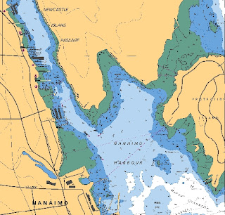
Whenever we pass through Nanaimo on our trip N or S we always anchor at Newcastle Island Marine Park.  Some may consider this as Nanaimo Harbor too.  I call it Newcastle Harbor because of the absolutely great Newcastle Island Marine Park.  It's a great anchorage - good sticky mud that will hold your boat securely.  Fairly shallow about 10'-40' so you don't need much scope, I generally anchor with a 3:1 scope and have always done just fine, even when it's blowing 25+ knots out in Georgia Strait.  On the N end you are bounded by Newcastle Island and some shoals - very visible at low tide.  To the E you'll find Protection Island.  Good protection from summer NW winds and SE storms.

During the summer months this anchorage can get quite crowded, not only from visiting boats but also from Nanaimo locals who just venture out for the day or evening.  You will have to pick your anchorage spot between long anchored local boats - some colorful and eccentric to others seeming to be only a short wait from a watery grave.  All makes and types of craft from all over the world you can find anchored in Newcastle Harbor. Sometimes you'll return from shopping in town only to find a boat anchored within 20-30' from you.  And, it's not a quiet anchorage, more like a party and city anchorage.  You always seem to hear the noise from the city - bands playing in the waterfront park, a roaring Harley on the streets, or the siren from an ambulance or the RCMP.  And, it's not a dark anchorage because of all the Nanaimo city lights.  Oh, and did I mention that it can be a busy anchorage?  The small ferries from Nanaimo to Newcastle Island are regularly traveling through the anchorage as well as kayaks, dinghies, runabouts, and boats. Newcastle Harbor is hive of activity.  But yet despite all this it is a favorite anchorage of mine.

You are very close to good shopping - fuel, propane, water, groceries, liquor, ice, marine chandlery, and good restaurants.  All within very short walking distance. The Thrifty Foods store has all sorts of sumptuous pre-barbeque fare such as marinated shrimp or chicken, or beef on skewers, ribs, chops, and steaks.  (I like the Cajun shrimp skewers, and Thrifty Foods makes a great Tzatziki sauce for dipping veggies.)  The marine chandlery just up from Thrifty Foods is packed with all sorts of marine supplies, parts and "stuff."  They seem to have everything.  Once you tire of the city and its fast pace, you can quickly and easily escape to nice walks through deep woods, beachcombing, a kiddie wading area and play ground, and picnicking on Newcastle Island.  There's a park concession which serves snacks and ice cream.  By the way, the park restrooms are nice and clean and have got great showers - just make sure to have a "loonie" or two (Canadian $1 coin). For a special treat you can visit the floating Dinghy Dock Pub which is only a short row from your anchorage. As a result, I've always thought that to fully enjoy Nanaimo it takes you at least 2-3 days here.  It's a great place to re-provision and relax just after or before "crossing the Monster."

When venturing N up Newcastle Island Passage make sure you do not exceed the speed limit of 5 knots.  The RCMP routinely use a radar gun to ensure boats travel the proper speed.  And I've seen the RCMP write speeding tickets which are often followed up by a boarding and safety inspection - ugh.  Also make sure you follow the channel, too many times you hear about a boat hitting the rocks in Newcastle Passage.

Dodd Narrows is only about 4.5 nm away and so Newcastle Harbor can be used as a staging area while waiting for slack.

Nanaimo 2011 summer special events:
  • July 8 - 10 Dragon Boat Races & festival.  Teams from all over BC and the US will take part in the 9th annual Save On Foods Nanaimo Dragon Boat Festival -- a weekend of competition, camaraderie and celebration on Nanaimo's waterfront. 
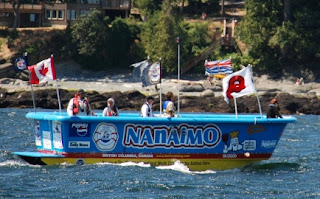
  • July 23-24 Nanaimo Bathtub Race weekend.  Watch high powered "bathtubs" race from Departure Bay and out into Georgia Strait.

Monday, February 14, 2011

Favorite Anchorages - Squirrel Cove, BC

I'm always happy to anchor at Squirrel Cove, BC.  I've either conquered "Crossing the Monster" (see previous post about crossing Georgia Strait) on my way N, or it's my last stop in Desolation Sound as I head S.  It seems that there's always room for just one more boat when you arrive late.  I always stay more than one night, just to relax and enjoy this very special anchorage - and so do many other boaters.  Squirrel Cove is one of those anchorages where it can be a party one day and offer quiet solitude the next.  I remember one year slowly motoring in my dinghy by a sailboat whose cockpit was filled with folks.  One was playing a guitar, another a recorder, and the rest singing.  I slowed, and said, "You know Red River Valley?"  Next thing you know they were playing and singing this old west favorite of mine.  I suspected as much and I was a bit sly, since I packed my harmonica with me hoping to join this party.  They invited me aboard and for the next hour I was part of this impromptu folk gathering.  It was great fun.  That's one reason why I enjoy Squirrel Cove.

"Dog Poo" Island
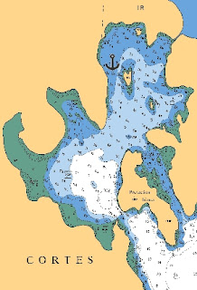
The anchorage is rather large and will suit almost any type of boat large or small.  During the height of the boating season in August I have counted more than 100 boats anchored throughout the cove.  Some prefer to anchor in the outer bay, whereas I prefer to anchor farther in.  There's lots of little nooks and crannies to anchor.  My favorite spot is just W of "Dog Poo Island."  I call it that because it seems everyone walks their dog on this island, including me.  Just be careful, the many oyster shells lining the shore can slice open your inflatable or badly cut your dog's paw.  By the way, it is illegal to harvest any oysters.

I have done a shore tie, but then other times I just use my anchor without a shore tie.  The bottom is a very sticky (and smelly) grey mud which will hold you fine, provided you have enough scope.  The inner bay depths are around 30 - 40' and around 60' deep in the outer bay.  Only once have I dragged anchor in Squirrel Cove and that was because of some very nasty westerlies that entered along with an unusually high tide.  Generally though the entire cove is sheltered from any strong winds, waves, and currents.  The only waves are from a rare few inconsiderate boaters who feel they can race through the anchorage. 

During the summer the cove fills with hundred of thousands of "moon jellies."  There's a resident population of Canada Geese which in the evening travel from boat to boat begging for hand-outs.  The ravens with their deep croak will call reminding you you're far from civilization.  Bald eagles will perch in the tops of trees.  And, I've seen an occasional otter or martin swimming along shore.  One evening I remember sitting out on deck listening to a Nighthawk feeding far above me.  Again a reminder that you're away in the wilderness.

The activities in Squirrel Cove are actually many for an anchorage in Desolation Sound.  You can order bread, or sticky buns, or a fresh fruit pie from the floating local bakery located in the cove.  You order the evening before and the next morning you can pick up your fresh hot baked item.  The Squirrel Cove bread is particularly good.  The favorite late afternoon activity is to slowly cruise through the myriad of anchored boats via your dinghy through the cove, and then once you're out of the cove go for broke like a madman to the Squirrel Cove Store about 1 nm away.  The store has liquor, ice, ice cream, fresh produce, meats, and a wide variety of groceries.  You can even get a marine part or fishing gear.  If you're not in the mood to cook, they've even got a small restaurant.  We always buy some fresh Squirrel Cove roasted coffee for the trip.  If your dinghy is a bit more stout, you can journey to Teakerne Arm to go swimming in beautiful Cassel Lake; or go to Refuge Cove for a hamburger.  At high tide you can either take your kayak or dinghy into the small lagoon at the head of the cove.  When you enter the lagoon it's another world away.  Just be careful not to get stranded by staying too long which is easy to do. One hot day, I anchored my dinghy right at the base of the lagoon outfall and enjoyed the mist to keep me cool.  You can also hike over to Von Donop Inlet on nice a wooded trail.  Or you can go swimming in the cove, the water is very warm. (The whole cove is a no discharge zone.)  There's just so many things to do.

When I am "upcoast" I always stop at Squirrel Cove. It's a definite favorite of mine.

Squirrel Cove is about 22 nm miles to the Yucultas, 24 nm miles to Campbell River, 12 nm from Prideaux Haven, and 12 nm miles to Lund.

Saturday, February 12, 2011

Summer Trip Planning - Canadian Rapids

As I continue planning my 2011 upcoast trip, it is important to consider the many tidal passes that you might have to navigate. A tidal pass is a narrow and relatively shallow passage that has a lot of current. At the peak of the current flow - ebb or flood - there are numerous water hazards which can dangerously affect your boat - whirlpools, boils (rising water), and overfalls (waterfalls & large standing waves). As a result, most tidal passes should only be navigated at slack to be safe. Slack is that very short time between flood and ebb, or ebb and flood where there is no current and lasts only minutes. Some slack periods last only moments. I remember once watching a stick slowly moving through Nakwakto Rapids in one direction, slowly come to a stop, and then reverse direction all in less than a minute. Less than an hour later the rapids were so bad that it would be dangerous for my boat the MV Independence to navigate.

When navigating a tidal pass at any time other than slack you need to know what your boat can do and what do in case of an emergency. Although rare, there have been incidents where a boat traversing a tidal rapid has been driven to shore, collided with other boats or objects, or worst of all - capsized! So timing your arrival to hit slack is important. That means knowing the currents leading up to slack, planning an appropriate anchorage, and knowing how fast your boat travels. If heading into current you don't make much way, and the current gets worse and worse. Once, I was actually going backwards - losing ground, while going forwards! Or worse yet, you get caught in the current which is going with you and you lose your steerage - scary.

The passes that I treat with great respect, that is I generally only travel through them at at slack (or near slack) are:
  • Dodd Narrows just S of Nanaimo. There are some overfalls and whirlpools, but the biggest concern is the amount of boat traffic through this narrow passage.
  • The Yuculta's (pronounced Yew-Caw-Tahs) - Yuculta, Gillard, and Dent rapids. There are boils, whirlpools, and very strong currents in these rapids. Boat traffic can be a concern.
  • Upper Rapids (Okisollo Channel). Large overfalls (>5' at times) and very strong currents.
  • Surge Narrows (Okisollo Channel). Narrow passage with very strong currents.
  • Skookumchuck Narrows (Sechelt Inlet). Large overfalls, very strong currents, boils and whirlpools.
  • Seymour Narrows (Discovery Passage). Boils, whirlpools, and very strong currents.
  • Nakwakto Rapids (Seymour & Belize Inlets). Boils, whirlpools, and very strong currents.

Other rapids that I respect but are willing to travel at any time because I have years of experience and knowledge with them are:

  • Malibu Rapids outside of Princess Louisa. Strong currents, some overfalls, navigation issues, and other boat traffic.
  • Greene Point Rapids (Cordero Channel). Strong currents, boils, and small whirlpools.
  • Whirlpool Rapids (Wellbore Channel). Strong currents, boils, and small whirlpools.
  • Chatham Channel. Currents, narrow channel, and shallow areas.
  • Lower Rapids (Okisollo Channel). Currents & some boils.

My strategy for all of these tidal passes is to approach them while the current is going against me, meet them at slack and then ride the current through on the other side of the pass. This is particularly so when traveling those tidal rapids in and around Desolation Sound. Because of heavy boat traffic and rough water I generally avoid Discovery Passage which is just N of Campbell River. Discovery Passage seems to really funnel the NW winds down through it. When the current is ebbing (going N) and there's a strong NW wind - it is a recipe for rough water that I absolutely avoid. The longer route is via the Yuculta's and upper Desolation Sound. Generally the NW winds don't enter these channels, and the scenery is so very nice. When traversing this route N I have a series of rapids to traverse - Yucultas, Greene Point, and Whirlpool. I time my arrival to the first rapid - Yuculta - when it is at the end of the flood. I then make Gillard right at slack, and ride the ebb through Dent, Greene Point, and Whirlpool Rapids getting a great "downhill" ride averaging well over 7+ knots.

When cruising S (again I avoid Discovery Passage because of the chance of rough seas and boat traffic), I generally travel through Whirlpool and Greene Point the day before and then go through the Yucultas separately. A trick I learned from fishing boat skippers when traveling S on your way to the Yucultas, is to travel as close as you can to the Sonora Island shore and ride the back eddies instead of plowing head-long into the current mid-channel. At times I am not more than 20' away from shore but the depth is more than 60'. I've passed boats traveling in mid-channel not doing more than 3-4 knots, while I'm riding the back eddies and traveling 7+ knots. Woo hoo!

Anchorages approaching the Yucultas are limited. When cruising N, you've got a great anchorage in Squirrel Cove (Cortes Island) which is about 20 nautical miles away - down Calm Channel and Lewis Channel. There are a few mediocre anchorages which are nearer - Florence Cove (Hole In The Wall), or Frances Bay (Raza Passage) which will do in settled weather. When cruising S, you can stay at Blind Channel Marina, Shoal Bay Marina, Cordero Lodge or anchor in Forward Harbor (Wellbore Channel) or Cordero Cove (near Greene Point Rapids).

For me cruising through these tidal passages makes for exciting and challenging fun. If done right, you won't even know the danger you passed through. For 2011 the date for me to travel through the Yuculta's are on July 24. I will raise anchor from Squirrel Cove at 8:30 AM, travel the 22 nm at an expected average speed of 5.5 knots putting me at Gillard Pass right about 12:45 PM - perfect. I will then ride through Dent with a push, down Cordero Channel with a push, and if I want - I haven't decided yet - go further through Greene Point and Whirlpool Rapids all with a good push. I'll save time and money (fuel).

Sunday, February 6, 2011

Summer Trip Planning - Crossing the Monster

Whenever planning a trip "upcoast" you need to carefully consider crossing "the Monster." Walt Woodward in his excellent little book - "How To Cruise to Alaska Without Rocking The Boat" devoted nearly a whole chapter to crossing the Strait of Georgia, which he called the Monster. After 21 years of experience, I have nothing but respect for this leg of the upcoast journey. A rough crossing can affect the whole rest of the trip.

What makes this body of water so feared or respected? Mostly it has to do with the geography. It's a large inland sea trapped between two mountain ranges - the mountains on Vancouver Island and the Coast Range on the mainlaind. These mountains form a venturi, or funnel for the wind that either comes from the NW or SE. Since the summer Pacific High forms in the Gulf of Alaska, I worry more about NW winds although you do get the occasional storm that will bring SE winds. These "moderate northwesterlies" can blow relentlessly for days on end. My observation is that the winds are always worse on the Vancouver Island side than the mainland side.

The winds are commonly worst in the early morning, dying down around mid-day, and then again picking up late in the evening or at night. So keep that in mind. The best tool for planning to cross the Strait is listening to the Canadian Weather Radio on VHF WX1 - Comox Coast Guard Radio. It is updated daily at 4 AM, 10:30 AM, 4 PM, and 10 PM, although the spot observations are updated hourly. I carefully listen to the weather observations for the following places:
  • Entrance Island - E of Nanaimo
  • Ballenas Island - W of Nanaimo
  • Sisters Island - W of Nanaimo, and mid-Georgia Strait
  • Merry Island - N of Nanaimo, and on the mainland side
  • Cape Lazo - Vancouver Island side
  • Grief Point - Near Powell River, mainland side
The wind reports at Cape Lazo, Sisters Island and Ballenas Island will give you the best picture of crossing the Strait. If the wind is blowing greater than 15 knots you're in for a rough ride - seas 3' or more. If they're blowing greater than 20 knots you're in for a terrible ride - seas 4' or more. Ugh! Another complicating factor is if Area WG - "Whiskey Golf" is active. Area WG is the torpedo testing range and any entry into this area when active is strictly "verbotten." No exceptions. Again the Weather Radio will tell you if "Whiskey Golf" is active. If so, you've got to stay clear of it by traveling W to Ballenas Island (via Ballenas Channel) and then make your way N across the Strait. If a strong NW is blowing that will put you "beam to" the NW waves & swell for about 5-8 nautical miles. "Whiskey Golf" is generally not active on Sundays.

My route, depending on winds... if 15 knots or greater I stick close to the Vancouver Island shore out of Nanaimo and will duck in behind the Winchelsea Islands. If the winds are too strong and the seas too rough I'll stay at a great nearby marina - Schooner Cove - and wait for the winds to die down. If not, I will turn just E of Ballenas and make for E end of Lasqueti Island (towards Squitty Bay). That will put me in beam seas to the NW waves and swell for only about 5 nm. I'll then duck into one of the many anchorages in and around Bull Passage of Lasqueti and Jedediah Islands.

If the wind is less than 10 knots and Area WG is not active, I will make for either the E end of Lasqueti or Texada Island (Upwood Pt.) and then travel up Sabine Channel or Malaspina Strait. If I choose to do Sabine Channel, the forecast has to be for winds less than 10 knots because once you get past Lasqueti Island you're open to the full NW open waters of Georgia Strait. You'll save about 8 nm going this route to Desolation Sound. Otherwise I'll travel up Malaspina Strait - careful, once you round NW point on E side of Texada Island the NW winds and seas can be terrible. Again, plan accordingly.

What I really like to do is leave Nanaimo, make a direct route to Bull Passage of Lasqueti Island, anchor, and then finish crossing "the Monster" for the next day. The whole time I am listening over and over again to the weather radio. This cruise plan breaks up the Georgia Strait crossing to 5 hours one day and about 9 hours the next day. And, there are so many places to enjoy and explore in and around Jedediah Island - its beautiful.

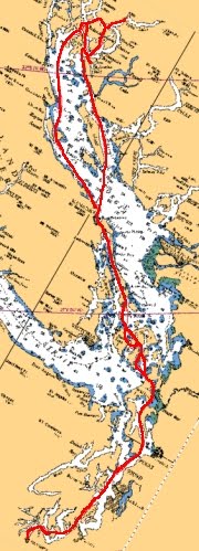
Finally, I always try to plan riding the flood when going up the Georgia Strait. There's not too much current but every little bit helps. Below is the tide chart for July 22 outside of Powell River. My plan here is to leave early from my anchorage in Bull Passage area and then ride the flood all the way to Squirrel Cove.